By Mariah Cannon

If you’ve ever spent any time on Pinterest or instagram, you’ve surely seen some photos of people doing some epic looking hikes in Oregon. Sometimes it can be hard to figure out where they are or which ones they are. I’m a big fan of not geotagging and doing your own research to find incredible areas to explore – so I’m hoping that’s why you’re here… To find some awesome trails to take on from doing some handy research and digging of your own. (I think that blog posts that people have to read to find out what they are help minimize those who will destroy out lands, because it involves too much effort). So now that we got the riffraff out of the way, let’s dig into it.
Things to Know Before you go
- A lot of these trails are rated as difficult, be sure to do proper research before going and ensure you are physically and mentally capable of doing these trails. Some require route finding, hiking through scree, up above 10,000 feet high, and can be harder on the body than you might think. Know what you can and cannot handle!
- Oregon weather is pretty unpredictable and it can go from sunny and 75 degrees to thundering and lightening in a matter of minutes when you’re in the mountains. Bring dry layers in the car for afterwards just in case.
- Always hike with your ten essentials – when exploring the mountains, it’s best to be prepared for anything – so having these items with you can make or break a trip!
- I use AllTrails Peak to track my hikes and plan for 95% of my adventures, you can try it out for 30% off your first year here!
- A lot of these are Central Oregon trails, with a few Columbia River Gorge trails, and one Eastern Oregon trail!
- Recreate reponsibly and leave no trace so generations after us can keep exploring this beautiful land we call home.
1. Belknap Crater & Little Belknap Crater

Distance: 7.3 miles round-trip
Elevation: 1,847 feet
Hike Type: Out & back
Difficulty: Hard
This trail is such a good one, and it’s not far from Black Crater, which I mention later. It’s mainly on lava rock and ash once you get near the summit. This trail is one you definitely start early on and bring plenty of water. This trail is accessible when Old Mckenzie Highway (OR-242) is open, typically from June-September. Always check snow and weather reports before going out! You do need to obtain a Central Cascades Wilderness permit before day hiking or backpacking this trail.
This one can be challenging because of the lava rock terrain, but it is great and the views of the cascade range are incredible! The mileage and elevation includes side questing over to little Belknap Crater, you can see it from the main trail and definitely do not need to go to it, it is a fun little shoot though if you want to! Otherwise you should walk about 6.5 miles round-trip and gain 1,700 feet.
2. Hamilton Mountain via Rodney Falls and Hardy Creek

Distance: 7.5 miles round-trip
Elevation: 2,228 feet
Hike Type: Loop
Difficulty: Hard
Okay okay, this one is typically on the Washington side of the Columbia River Gorge, but it’s close enough and it’s a badass trail, so we’re adding it! When you think of the pacific northwest, this trail encompasses what you would typically imagine – lush, green, rugged, tons of views. You start from Beacon Rock State Park parking to begin the trail. This trail starts off in the lush forest and kicks off with a stunning waterfall/bridge action at Rodney Falls, before you begin your main climb. You gain a lot of elevation in a little amount of mileage and hike up some pretty exposed rock areas and get beautiful glimpses of the Columbia River and the Oregon side of the gorge.
This trail doesn’t really have a proper summit with epic views, the way up is more scenic than the actual summit point – it’s kind of covered in bushes and you can’t really see anything. Keep going and make your way around the loop, you’ll find yourself on an old skid road for a little bit of the trail.
3. Tunnel Falls Via Eagle Creek

Distance: 13.6 miles round-trip
Elevation: 2,572 feet
Hike Type: Out & back
Difficulty: Hard
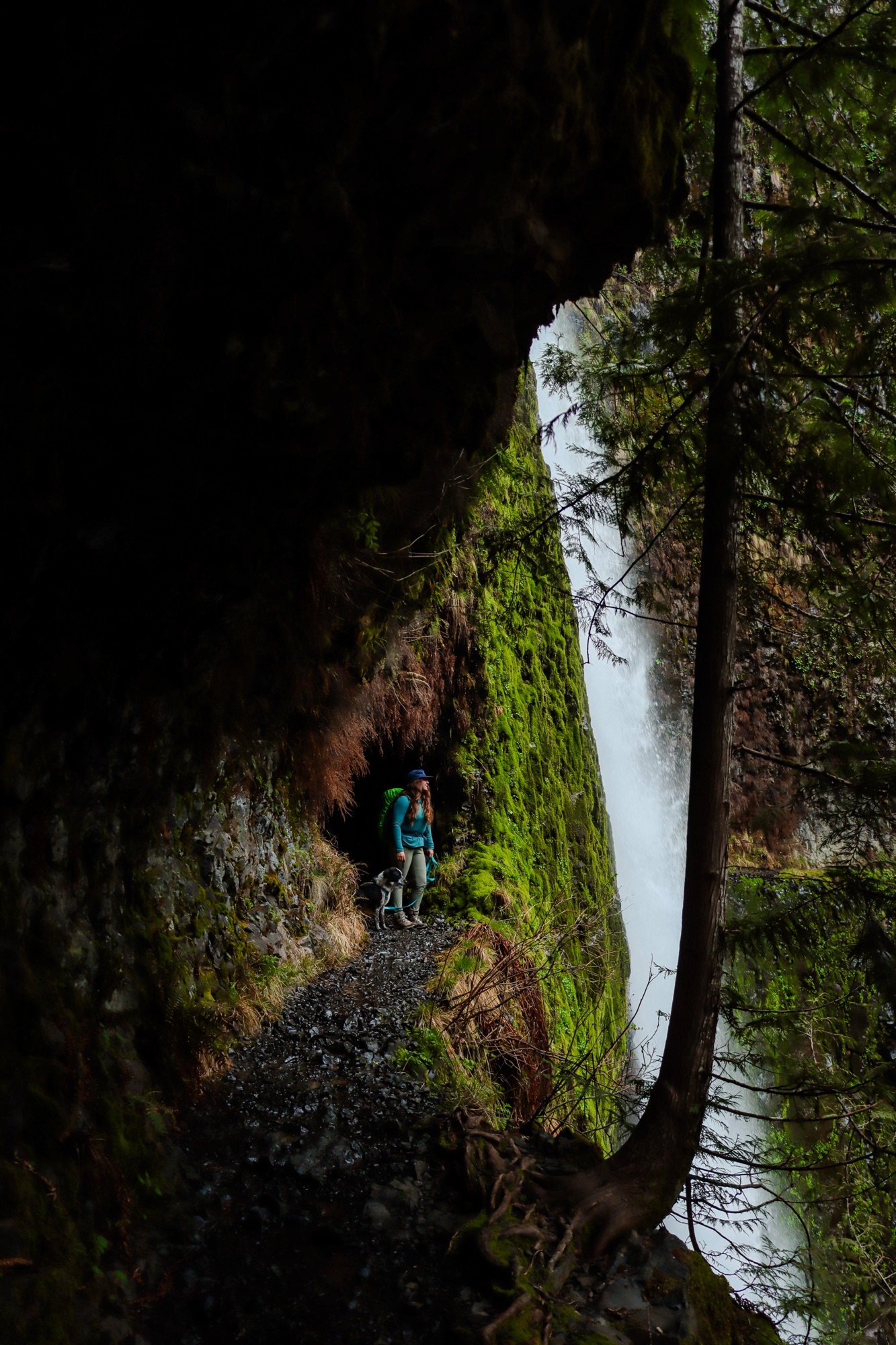
This is a major Oregon bucket list hike, but it is not for the faint of heart, be prepared for the long mileage, slippery terrain, and steep drop offs. This is probably one of my favorite trails in the Columbia River Gorge, one we usually do every year. It’s lush, green, has tons of waterfalls, fun bridges, and is just overall a beautiful trail.
4. Burma Road to Gray Butte

Distance: 15 miles round-trip (if you go around on the river trail on your way down) otherwise 13 miles round-trip as an out and back.
Elevation: 2,858 feet
Hike Type: Out & back or loop
Difficulty: Hard
Burma road to Gray Butte is a wonderful training trail and on a clear day, there’s stunning views of all of Central Oregon and the cascade mountains. It’s a popular running trail, but it’s typically less busy than the main part of Smith Rock State Park. The terrain is rocky and dusty and there’s very minimal shade throughout, so wear your sun protection and bring lots of water with you. Once you get to the North side of Burma heading towards Gray Butte, you leave the state park and start climbing on BLM land!
5. Black Crater

Distance: 7 miles round-trip
Elevation: 2,319 feet
Hike Type: Out & back
Difficulty: Hard
Black Crater is one of those gorgeous trails in Central Oregon that truly feels like another planet. Between the burn scars, the lava and cinder at the top, and the surrounding cascade mountain range – you will not be disappointed. This trail gains a lot of elevation, but it is a steady climb and there are not really any spots that are super steep. You need to fill out a self issued permit if day hiking at the trailhead, but if you are planning to backpack, you will need to reserve your permit in advance on recreation.gov!
6. Wildhorse Lake

Distance: 2.4 miles round-trip
Elevation: 1,049 feet
Hike Type: Out & back
Difficulty: Hard
Wildhorse lake is STUNNING and so underrated. It’s located in the Steens Mountain range and is literally unlike any other mountains in Oregon – it feels like you’re in a whole different state. You start this trail by dropping down into the lake and then all of the elevation is on the way back to your vehicle.
Cody and I did this in June of 2025 as a quick one night backpacking trip and it was magical! It was only us and two other tents way across the lake. There was still a little snow on the trail that required some navigating on the way down since it was so early in the season. Make sure to check snow reports and with local rangers before heading out to the area.
7. Dog Mountain

Distance: 6 miles round-trip
Elevation: 2,800 feet
Hike Type: Out and back or loop
Difficulty: Hard-Strenuous
This trail was one of those one and done(s) for me. I did not like this trail at all, but I was training for a backpacking trip and it helped my endurance a lot! And it’s definitely a hike to make you feel super accomplished. The best time to visit this trail is definitely in the Spring time when all of the Balsam Root and Lupine flowers are in bloom. This can vary year to year, but typically around mid April to early May is a good bet!
8. Canyon Creek Meadows/Three Fingered Jack

Distance: 7.6 miles round-trip
Elevation: 1,600 feet
Hike Type: Loop
Difficulty: Moderate
This is one of my very favorite trails/mountains in Oregon. It is so beautiful. Lined with mountain goats, black bears, deer, wildflowers, and alpine meadows and lakes – plus a stunning view of three fingered jack and surrounding mountains depending on how far up you go. Most of this hike is in the trees and the last mile is up a boulder field and exposed. That section is where you’ll likely see mountain goats and have some really epic views. Bring your binoculars to see the goats from afar!
You will need to purchase a Central Cascades Wilderness Permit to day hike and backpack this trail.
9. Mount Bachelor

Distance: 8 miles round-trip
Elevation: 2,766 feet
Hike Type: Out & back
Difficulty: Hard
In the Summer months, Mount Bachelor is a wonderful area for hiking and biking. The hiking trail up mount bachelor is a challenging, but really fun one. You spend a lot fit crossing by and under the ski lifts before hitting some boulder fields and many small switch backs to get to the summit. And you do not need a permit for this trail! The weekdays are pretty slow, but the weekends are busy – so be on the lookout for mountain bikers when at trail intersections!
I linked the loop trail above, although we just did it as an out and back – either is great!
10. South Sister Summit

Distance: 12.2 miles round-trip
Elevation: 5,692 feet
Hike Type: Out & back
Difficulty: Hard
South Sister is one of those mountains that you should absolutely take on when in Oregon! It’s challenging, beautiful, and so worth the time and energy it takes! You start at the Devil’s lake parking area an begin climbing through the forested area for a couple of miles before getting out to the alpine meadows and to where you can see your end point.
You do need a Central Cascades wilderness permit to day hike and to backpack this trail, you can get them on recreation.gov!

Enjoy this guide to some epic hikes in Oregon? Be sure to save it for future adventures!
Let’s Get Adventuring!
Mariah 🙂

Leave a Reply