By Mariah Cannon

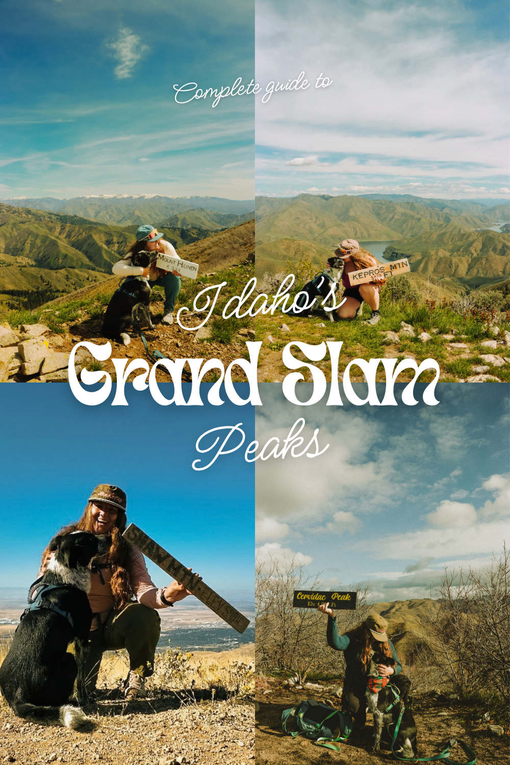
Idaho is truly a hidden gem and so underrated! There are so many good hiking trails, especially peaks spread out across the state. A more common challenge to the locals near Boise – the Grand Slams – it’s a peak challenge that is made up of four different peaks; Cervidae Peak, Kepros Mountain, Shaw Mountain (Lucky Peak), and Mount Heinen.
All of these peaks have one thing in common… They’re absolutely brutal. Kidding, somewhat… These peaks are quite the challenge in terrain and steepness and for some, even the distance. They range from 4 miles to 11 miles round-trip and in total with all four of these peaks, you’ll gain a bit more than 10,000 feet of elevation. So let’s get into it.
I’m going to list them in the order I did them in, however they can be done in any order you want! A lot of people choose to end with Mount Heinen as it’s the most strenuous/most elevation gain.
I use AllTrails Peak to track and plan all of my hikes. You can save 30% on your first year here!
Things to Know Before You go

- Three out of four of these trails are exposed for most of the trail and can get hot during the Spring and Summer months. Make sure you’re prepared with all of your sun gear, hydration, and food. These are my favorite things to bring on a sunny day adventure.
- These hikes are not beginner friendly and require some hiking background along with proper preperation! Make sure to properly fuel your body and hydrate the day before.
- Dogs are allowed on all these trails, but must be on a leash from Nov-April for wintering wildlife.
- Always remember to bring your ten essentials and have anything you may need if something goes wrong on your hike.
- Like many of the trails here in Idaho, you will not be going only up on the way to the summit and only down on the way back to the trailhead. These trails consist of both a lot of uphill and downhill, so your calves and lungs will take turns burning and getting breaks!
- Wildlife sightings are common! Typically deer, badgers, coyotes, and maybe even elk can be found on these trails. Never feed wildlife and always make sure to maintain a good distance.
Peak #1 Cervidae Peak

Distance: 4.6 miles round-trip
Elevation: 1,912 feet
Hike Type: Out & back
Difficulty: Hard
This one is definitely one of the more easier ones in terms of distance and ultimately steepness too. With it gaining just under 2,000 feet in elevation over 2.3 miles uphill, it is definitely challenging – but compared to the other three in the grand slam challenge, it is easier.
This trail kind of goes up and then plateaus for a second, then goes up again and- well you get the point. It also has some killer downhills you’ll take on on the way to the summit, which means a couple of uphills on the way back down.
It is fully exposed, with no tree or shade breaks – bring more water than you think you’ll need. I really love this trail during the fall time as it’s cooler and there are just a few fall colors you’ll run into. A lot of people choose to visit in the mid spring time for all of the Balsam Root and Lupine that “superblooms”.
Peak #2 Kepros Mountain

Distance: 10 miles round-trip
Elevation: 2,149 feet
Hike Type: Out & back
Difficulty: Hard
I liked this trail a lot – right from the get go, it goes straight up! And then it kind of flattens out for a bit before some minor ups and downs and then arriving to the summit. The summit of this one is the most rocky and has a little bit of a steep scree the last half mile.
I really liked the first 2 miles of this trail as the views are epic and the hike itself is not too challenging. The first half mile is extremely steep and it makes you question what you’re doing, but once you get passed that, it really isn’t too bad.
Peak #3 Mount Heinen

Distance: 9.8 miles round-trip
Elevation: 3,734 feet
Hike Type: Out & back
Difficulty: Hard-Strenuous
This was one trail I will likely never do again here in Idaho… Let me tell you why. It is ridiculously challenging and the reward is not that stellar… Yes, I said it. I feel like Kepros and Cervidae have basically the same view and are a lot less of a challenge, but I think it should definitely be done once to check off the list if nothing else!
It is incredibly steep, right out of the gate basically and you just keep climbing and climbing and it feels like it’s never going to end. I will say, the first 2 miles are incredibly pretty – you have a killer view of the reservoir, surrounding mountains, and the skyline before you get into the tree line. It feels very Idaho. I went in the spring time, early April and the weather was almost too hot already, Maverick and I were ready for the ice cold drinks waiting for us in the cooler. Everything was green and the Balsam root along with other wildflowers were nearly in peak bloom, so that was one very positive thing of going when I did!
I highly recommend starting early to avoid the heat. Bring lots of water and snacks, especially for the pups.
Peak #4 Shaw Mountain (Lucky Peak)

Distance: 7.84 miles round-trip
Elevation: 2,415 feet
Hike type: Out & back
Difficulty: Hard
I saved Shaw Mountain for the my last peak as I figured it would be a nice easier one to end on. I should also add, I went up through Adelmann Mine versus going all the way up Shaw Mountain road. This way provides more of a trail feeling and keeps you off of an access road for the majority of the hike. And you can swing by Adelmann mine as a fun little side quest by going up to Shaw Mountain this way!
I did this trail in September of 2026 and the fall colors were just about at peak which was super awesome to get to see! We did not pass anyone on trail until the very end back towards the trailhead of Adelmann mine.
Maverick and I also saw some grouse and turkey while hiking (first time seeing turkeys on trail)!
If you choose to go up on the access road, this is what you’d be looking at for stats:


Enjoy this guide to Idaho’s Grand Slam Peaks? Be sure to save it for future adventures!
Let’s Get Adventuring!
Mariah 🙂

Leave a Reply