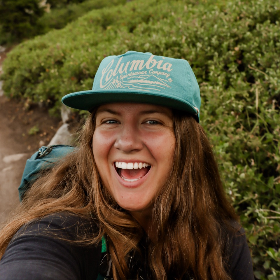
In January of this year, I set a goal for myself of 100 hikes in 2022. It’s September 3rd, and I accomplished just that. I originally got the inspiration last year thanks to Giselle and Stephen from @theloverspassport on Instagram. When I first started this challenge, 100 sounded like a lot, and it definitely is in ways, but I have a good three-four months left of hiking for the year and am going to surpass my original goal. Stoked is an understatement. Proud of myself for branching out, hiking with new friends, growing the confidence to hike solo when no one else could go, and bettering myself mentally and physically.
With that being said, cheers to 100!🥳
Below I’m going to mention my favorite hikes that I’ve done, some I didn’t care for, ones I thought were over/under rated, and just overall reflecting on the past 100 hikes and 360 miles of trail. I’ll share 3 waterfall hikes, 3 viewpoint hikes, 3 random trails I loved, and my 100th trail!

My Favorite Hikes
It’s hard to really pick an overall favorite when you’ve done so many trails and think every single one of them is a 10/10 lol, but here are some I truly enjoyed everything about, ranging in no specific order.
#36. Wahclella Falls

Distance: 1.9 miles round trip
Elevation: 223 feet
Difficulty: Easy
Hike Type: Out & Back
Permit/Pass: Northwest Forest Pass or $5 fee at self serve kiosk.
Closest Town: Cascade Locks, Oregon
This trail to me was INSANE. A must on the Columbia River Gorge. We visited this trail in the late spring this year as a last minute stop after hiking Dry Creek Falls and Beacon Rock. We arrived at the trailhead at about 5pm and ran into about 5 other groups! So worth the stop! Find directions to Wachlella Falls on All Trails!
#20. Gray Butte via Cattle Gate

Distance: Roughly 7 miles round trip
Elevation: 2,014 feet
Difficulty: Moderate
Hike Type: Loop or Out & Back
Permit/Pass: None
Closest Town: Culver, Oregon
I had stared at this butte for probably a year before I got to summit it. It looks like such a massive butte for where at in Central Oregon it sits. The weather couldn’t have been more awful when I decided to do it, and there was still a good snow field on the North Side. Coming down without YakTraks or poles was interesting to say the least… Beautiful views and definitely an underrated hike! Directions to Gray Butte on All Trails.
#34. Dry Creek Falls

Distance: 4.4 round trip (I pulled about 5 miles, but every recording says 4.4).
Elevation: 885 feet
Difficulty: Moderate
Trail Type: Out & back
Permit/Pass: None
Closest Town: Cascade Locks
This trail was actually one Alex had picked for us that day and I wasn’t sure how it was going to be with the fog and amount of cars at the trailhead, but it turned out to be one of our favorite trails! We got to the Columbia River Gorge around 7:30 and immediately hit the trail. The fog was thick and the air was humid, so views on the way to the falls weren’t that exciting until the fog lifted on our way down. But, oh my goodness, the falls was stunning! Definitely a talked about trail and with good reason!
The rock like columns on the side give it that mystic Icelandic feel and the slot canyon that the creek up top runs through is breathtaking. It was definitely a 10/10 hike for both of us! Directions to Dry Creek Falls on All Trails.
#35. Beacon Rock

Distance: 1.5 miles round trip
Elevation: 574 feet
Difficulty: Moderate
Hike Type: Out & back
Permit/Pass: You will need a Discover pass or pay $10 at the self serve kiosk.
Closest Town: Bonneville, Washington
This trail had been on my list for so long, it was a bucket list hike to say the least! I mean you literally climb up the sides of a rock, without getting technical. Sounds like a win to me. You climb a lot of elevation in little mileage, but the feeling of being on the side of a rock just takes all that off your mind. This trail blew my mind, it was incredible! It is definitely crowded though.
I highly recommend this trail if you’re on the Columbia River Gorge, keep in mind if you come from Oregon, you’ll have to pay a toll to cross the Bridge of the Gods. Directions to Beacon Rock on All Trails.
#39. Blue Mesa Trail

Distance: 1 mile round trip
Elevation: 115 feet
Difficulty: Easy
Hike Type: Loop
Closest Town: Holbrook, Arizona
Permit/pass: An America the Beautiful Pass or $20??? Entry fee
This trail is located in the Petrified Forest National Park near Holbrook, AZ. Outside of Oregon, this trail is probably in my top few hikes. It is such a unique trail, and it’s not super popular which just gives it that extra special feel. You drop down into a canyon of Painted hills and they are all different shades of grey and purple.
Pictures do not do it justice. This was the only trail we were able to do while in the park, but it was enough for the whole park. This trail has everything! Directions to Blue Mesa Trail on All Trails.
#62. Historic Black Butte Trail #4026

Distance: 10.5 miles round trip
Elevation: 3,389 feet
Difficulty: Moderate to Difficult
Hike Type: Out & Back
Permit/Pass: Northwest Forest Pass for parking
Closest Town: Sisters, Oregon
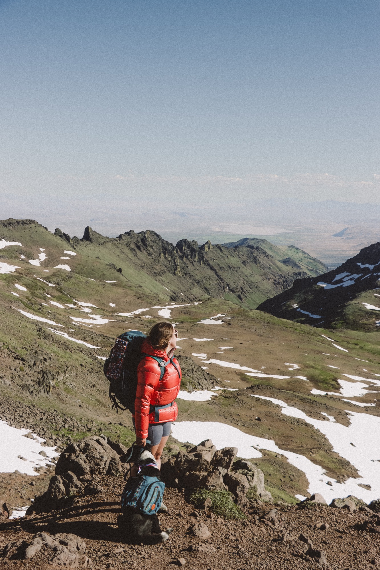
This is one similar to Gray Butte for me, I had stared at it for so long, I felt as though I knew everything about it. A friend and I did this trail from the bottom back in May, as part of the Six Packs of Peaks Challenge. There was still a mass amount of snow on the top and a field you had to cross on the North side going up. But the best part was, we were the only ones who started from the bottom and started that early, we had the top to ourselves and most of the trail on the way up. Such a hard but rewarding climb!
A lot of people start from the parking lot half way up, and that’s great because you still get a ton of elevation gain. It’s a challenge, but if you have time, I highly recommend it!
#68. Mirror Lake

Distance: 4.2 miles round trip
Elevation: 672 feet
Difficulty: Moderate
Hike Type: Out & Back or Lollipop Loop
Permit/Pass: Northwest Forest Pass needed for parking.
Closest Town: Government Camp, Oregon
There has always been so much rave about this hike, it’s been on my list for several months. I think I thought it would be one of those trails that everyone overrated and it wasn’t gonna be that great… Boy was I wrong. The beauty of the lake itself and then you add the scenery you get around the lake and it makes it a 10/10 lake.
On a clear day, I’m told Mt. Hood is visible from the SouthWest side of the lake. Unfortunately when Alex and I went, there was a ton of fog. We also couldn’t make it all the way around the lake due to snow and boards sinking in water on the West side (that was SO much fun lol). The parking lot fills up fast, get there early and you’ll find more solitude! Find directions to Mirror Lake on All Trails.
#97. Black Crater

Distance: 7.5 miles round trip
Elevation: 2,322 feet
Difficulty: Moderate-Difficult
Permit/Pass: A day use permit is required, purchasable here Make Reservations.
Closest Town: Sisters, Oregon
On the McKenzie Scenic highway (OR-242) about 15 miles outside of sisters, sits Black Crater. And it is beautiful. The trail goes through an old burn zone and it’s pretty exposed the whole way up. We had done Bachelor before this and I think it made it seem way easier. It was a gradual incline, and a really enjoyable trek with gorgeous views the entire trail. We started right as the sun was coming up and made it to Summit at 8:30am. Coming down it got a little toasty, and we were grateful we had started early. Definitely an underrated trail, the views make up for the exposure on the trail!
This trail is also part of the Six Pack of Peaks and was our fourth summit for the challenge! Directions can be found on All Trails.
#70. Spirit Falls

Distance: 1 mile round trip
Elevation: 433 feet
Difficulty: Hard
Hike Type: Out & Back
Permit/Pass: None
Closest Town: Underwood, Washington
This trail was a last minute decision, due to the Vista House being closed when we arrived on the Washington side. A quick search of nearby spots on All Trails and boom a beautiful trail, with solitude. There is many other trails that lead down to the falls and are on private property. Make sure you do your research and take the right trail down! It is a steep climb down to the falls, bring hiking poles. It is also very wet and muddy, making it extra slippery. Very gorgeous trail, but I only recommend it after doing the research. It can be a very dangerous trail if not careful and sure footed.
#100. Matthieu Lakes🥳

Distance: 6 miles round trip
Elevation: 817 feet
Difficulty: Moderate
Hike Type: Out & Back or Loop
Permit/Pass: Central Cascade Wilderness Permit available on Purchase Permits.
Closest Town: Sisters, Oregon
Such a beautiful lake hike, on the way up there’s a pond, North Matthieu Lake, and South Matthieu Lake. The trail is a steady incline up to the South lake. When you arrive at the end, you’ll pass quite a few backpackers and PCT Hikers depending on time of year visiting. The view of the North Sister is absolutely incredible. It feels like you can reach out and touch it. Definitely a popular trail on the weekends, but I’d say the views make it worth it!
Alex and I went on this trail as a sunset hike after work and I was so tired, but was so excited to complete my 100th hike and check out this amazing trail! So glad we were able to do it. It’s definitely a trail I want to backpack. It was so peaceful simply because the only other people we seen were at the lakes, one of them being the ranger checking permits. I really loved the construction of the trail itself, the sand, rocky section, and lava fields to the West side. Find the trail here Matthieu Lakes Trail.
Reminders:
• Always practice the 7 leave no trace principles. If you pack it in, pack it out. Leave the land better than you found it. Stay on the trail. Never carve on rocks or trees. Never feed or attempt to approach wildlife.
• Know that you may encounter wildlife on these hikes and any hike you may do in the future. It’s important to research before heading out and be prepared based on wildlife in the area.
• Be respectful to other hikers/runners/mountain bikers/horseback riders. Let faster hikers pass, know that uphill hikers have the right away. At viewpoints and popular areas, don’t hog them – always take a minute to take pictures then step aside so others can get theirs.
Let’s get adventuring!
Mariah


Leave a Reply